See, Understand,and Act on Reality
We provide the technological infrastructure that helps organizations optimize outcomes through advanced data management and real-time analytics across emerging markets.
TRUSTED BY
Impact measurement beyond borders
We provide everything you need to collect authentic field data and run complex geospatial analytics, built exclusively for organizations driving change.
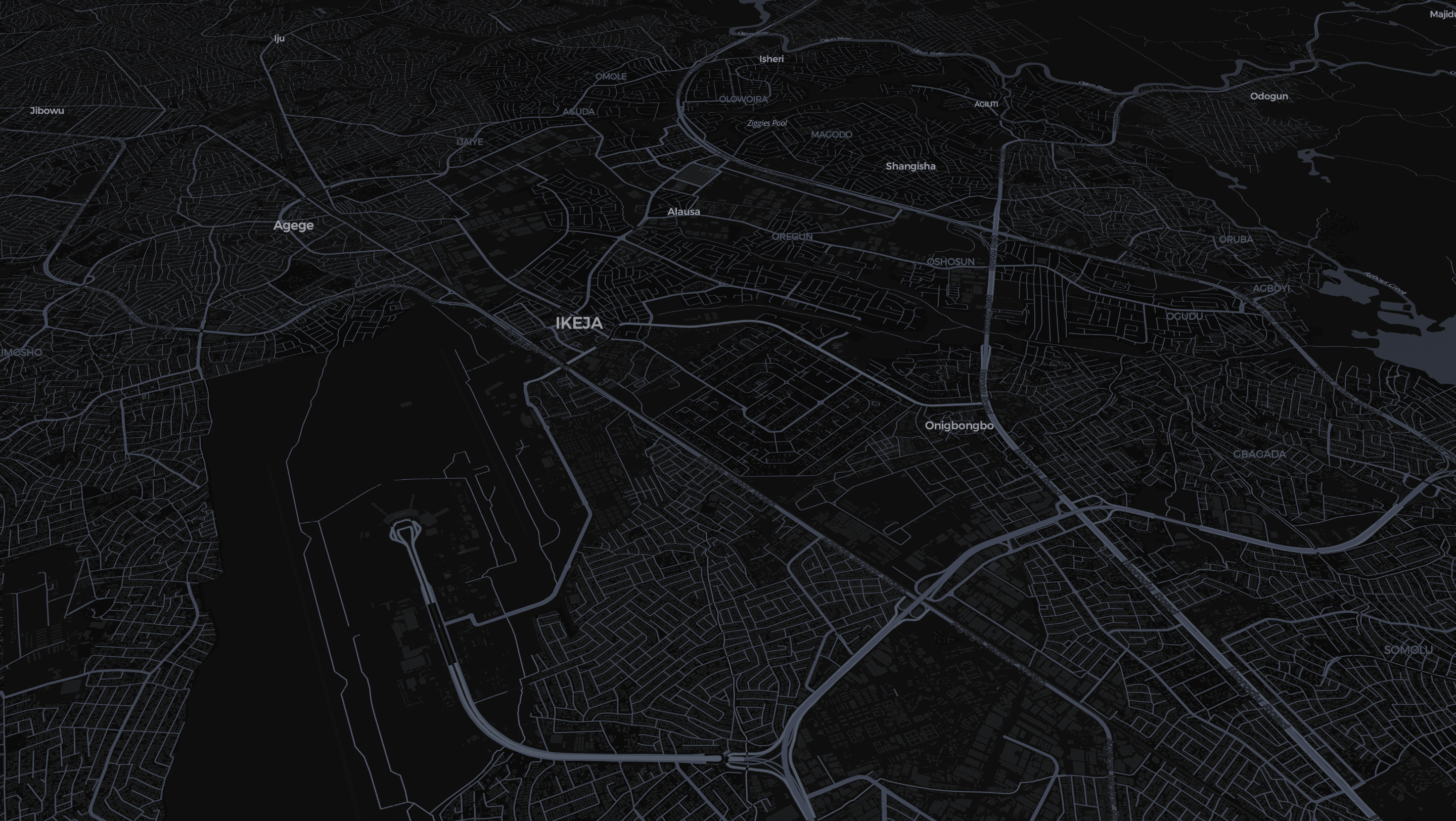
Geospatial Analytics
From maps to meaning. Transform raw locational data into interactive maps and dynamic dashboards. Identify service gaps, track infrastructure across regions, and make faster data-backed decisions.
- Live project tracking and site distribution
- Identify demographic gaps and regional vulnerabilities
- Share secure, filterable dashboards internally
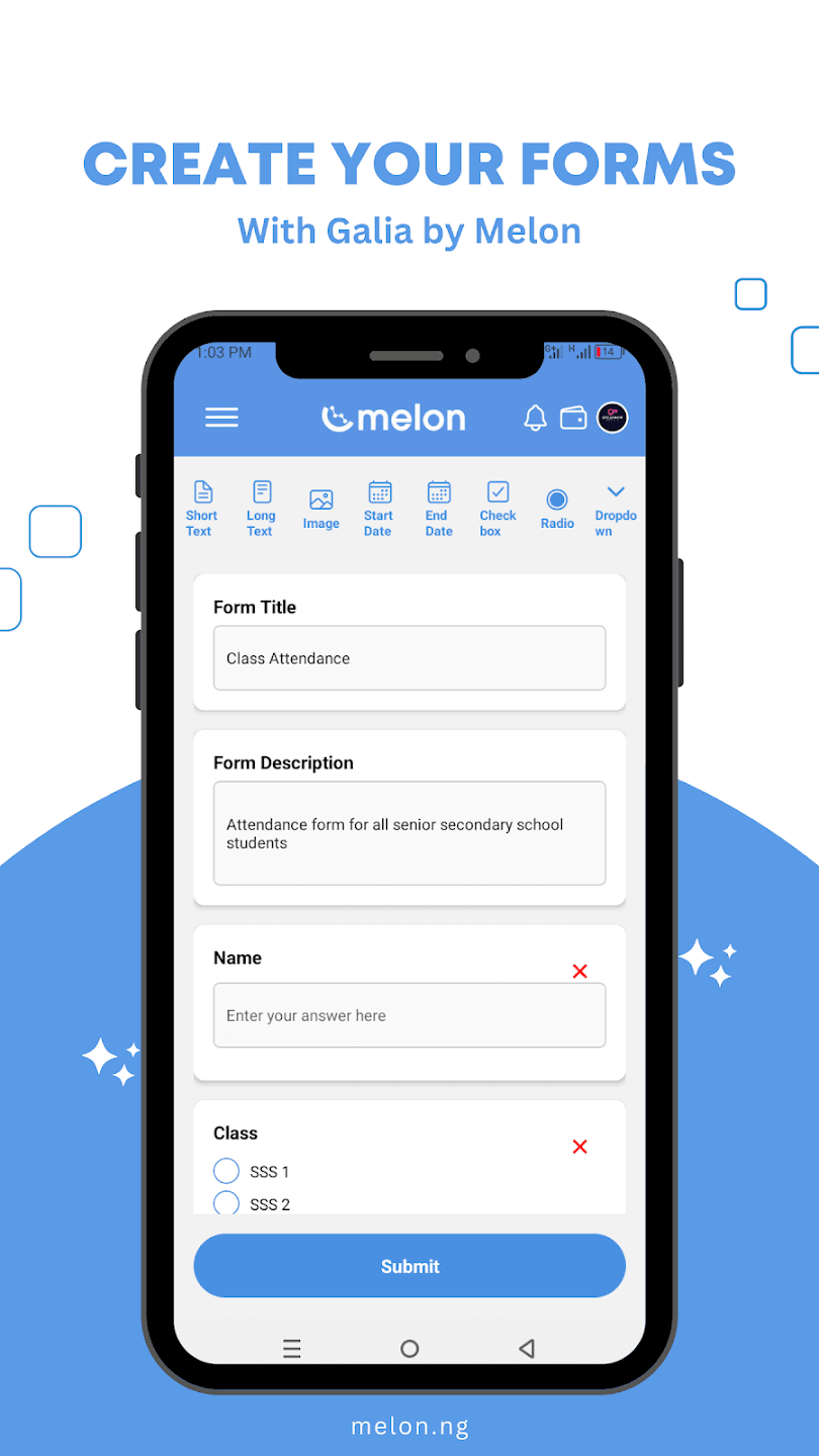
On the ground data
Your reach, our boots on the ground. Deploy surveys, gather geotagged evidence, and reach grassroots communities at scale without needing to build an in-house field team.
Geotagged Evidence
Every photo and response is strictly tied to coordinate locations.
Offline Sync
Collect data in deep rural sectors and sync automatically when online.
Platform Ecosystem
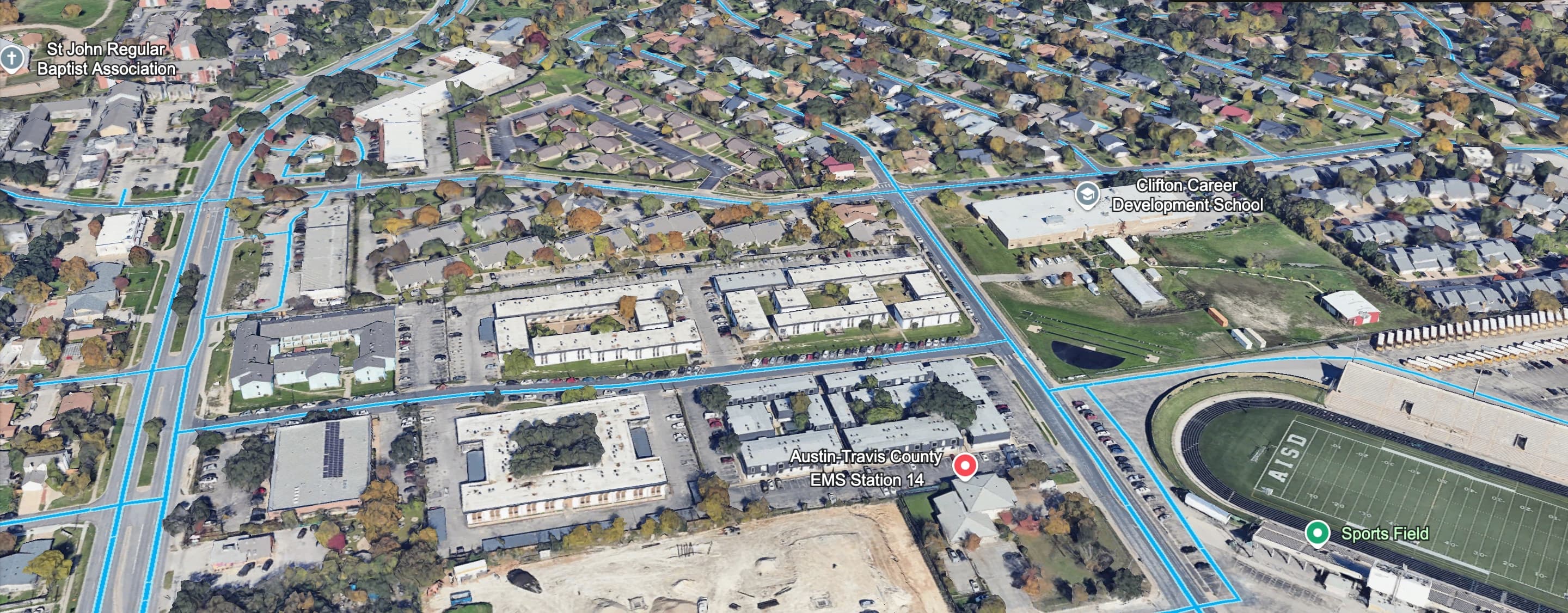
Satellite Asset Mapping
SIZE: 1.2MB // RES: 1080P
Real-time Tracker
SIZE: 1.2MB // RES: 1080P
ECOSYSTEM PARTNERS
Solution Architecture
Data-Driven Insights,Smarter Decisions
Access real-time geospatial intelligence and analytics for informed decision-making in public health, agriculture, energy, and other key sectors.
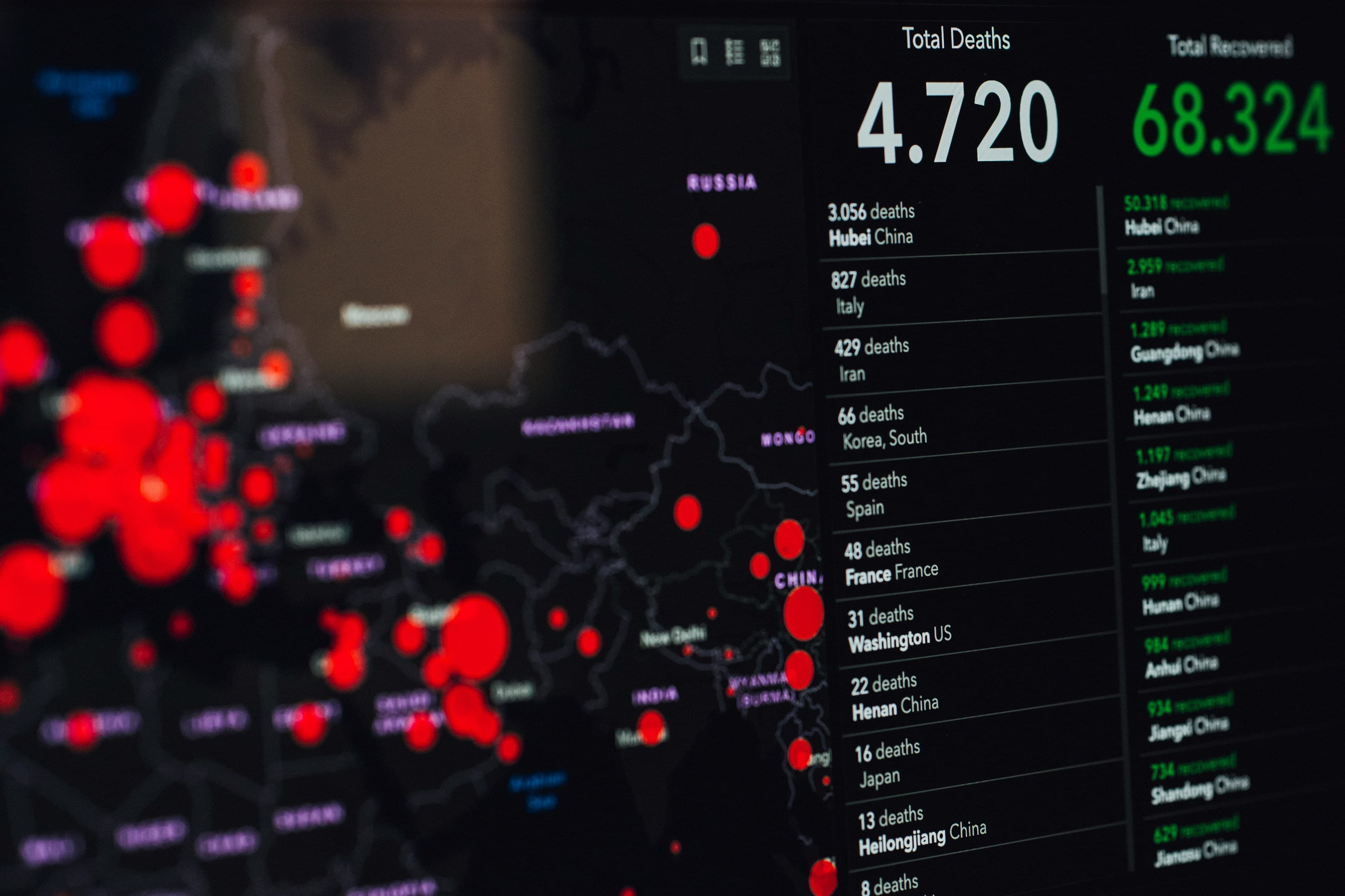
Neural Mapping
Mapping the Future,One Data Point at a Time
Use AI-powered mapping to visualize disease patterns, market trends, and infrastructure gaps instantly across the globe.
Field Operatives
On-the-Ground Data,At Your Fingertips
With sophisticated field agents nationwide, we collect, verify, and deliver hyper-local, cryptographically secure data that traditional surveys miss.

FEATURED IN
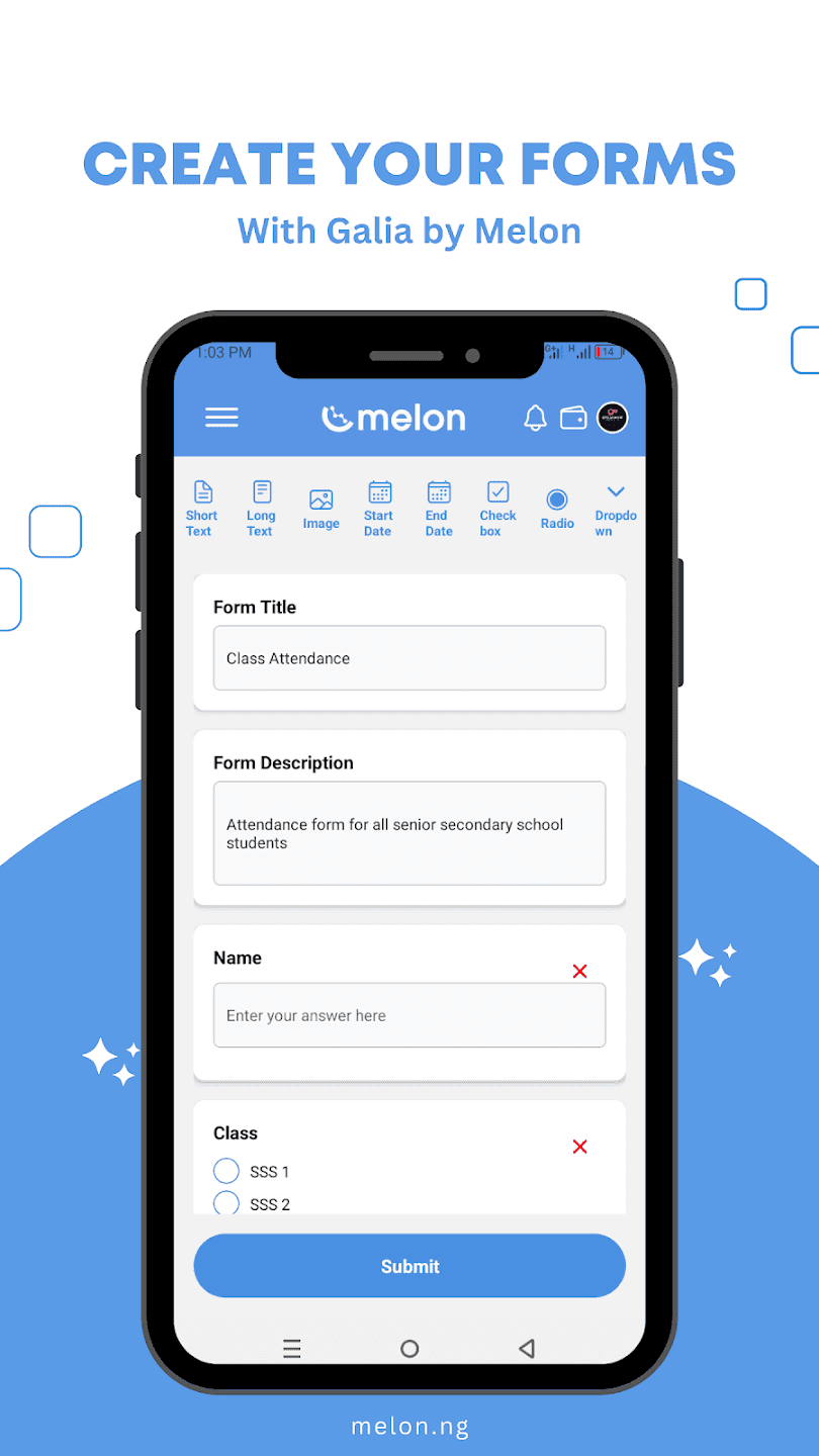
Empower Your Field Workforce
Join 2,000+ vetted agents transforming geospatial data into economic opportunity. Download Galia to start verifying assets and earning rewards today.
Frequently Asked Questions
Everything you need to know about the Melon platform and services.